Project Summary: Mashpee’s Popponesset Bay Inner & 1916 Channels
Project Summary: Mashpee’s Popponesset Bay Inner & 1916 Dredging Projects
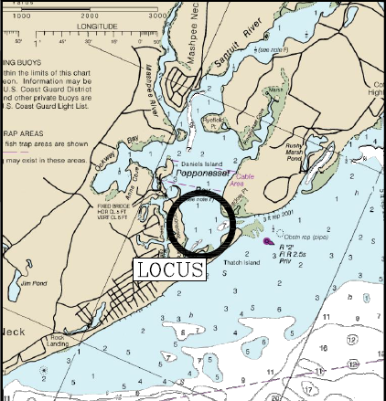
Two projects were completed in Popponesset Bay for the Town of Mashpee and the Save Poppy Bay coalition in October. A little background on Popponesset Bay. Save Popponesset Bay is the owner of 2/3’s of the Spit, with the eastern third, owned by Mass Audubon. The entire Spit is home to the endangered plovers and terns which bring about numerous restrictions on the times that dredging and maintenance can occur. The State owns the section of the Spit immediately at the bottom of the Fisherman’s landing stairs.
The first project was the Inner Channel, dredging started on October 12th, and was completed on October 16th. The estimated volume to be dredged from the Pre-Dredge Survey was 2,117 Cubic Yards with the final volume removed being 1,610 Cubic Yards. One interesting part of this project was that there was a telephone cable no longer in use that was reported to cross the channel and the last time that the County dredged this channel the dredge hit the cable causing damage to the hydraulics on the cutterhead motor. As part of the research in trying to determine the history and location of this cable, we were provided with a newspaper article from the 60’s when the cable was first laid (Popponesset Crossing Article).
Wanting to prevent a reoccurrence of this, the County requested that the town contract with a local survey company to locate and mark the position of the cable. This was done and fortunately the location of the cable was to the north of the area needing dredging.
The second project was the 1916 Channel, with dredging starting on October 18th, and ending on October 29th. The estimated volume to be dredged from the Pre-Dredged Survey was 3,688 Cubic Yards with the final volume removed being 3,454 Cubic Yards.
The dredge pipe for both projects ran from the dredge across the spit and down to the Fisherman’s Landing area then back to the mid-spit area to help build up the front facing part of the beach/spit. The dredge pipe lengths were 3,000′ & 4,000′ respectively. Both projects were completed by the Cod Fish II.
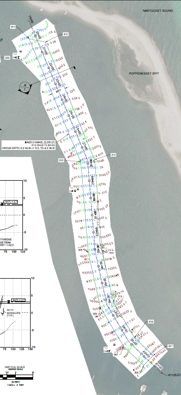
The following images detail the Pre and Post Dredge Surveys for both channels.
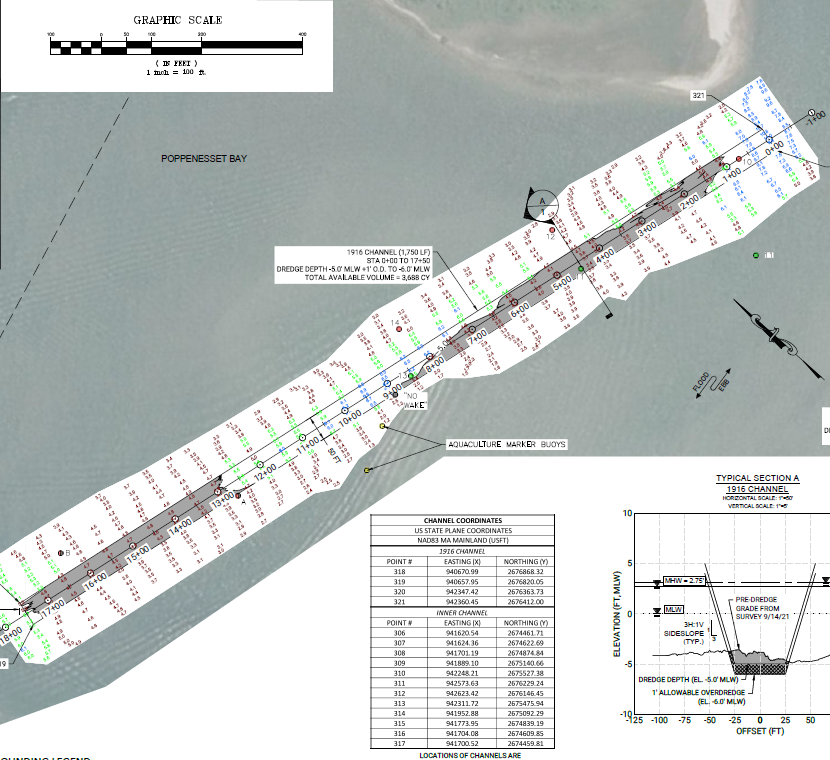
1916 Channel Pre-Dredge Survey – the shaded areas are the sections of the channel that require dredging.
This channel is authorized to -5′ Mean Low Water (MLW) with a 1′ Overdredge allowed.
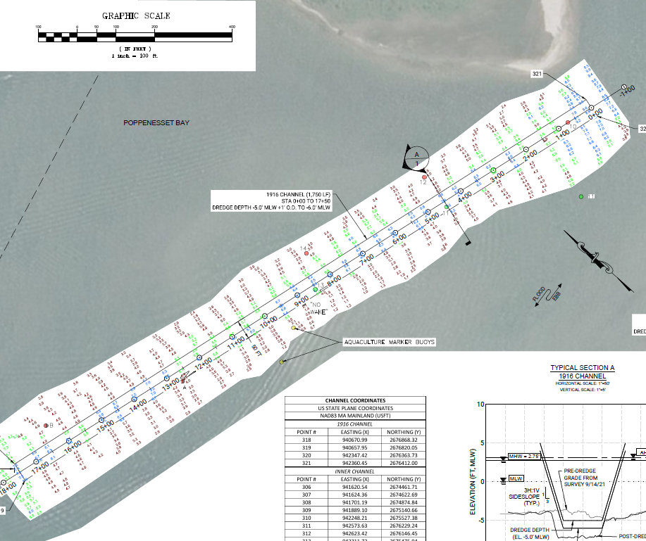
1916 Channel Post-Dredge Survey – the shaded areas that were shown in the Pre-Dredge survey have been removed.
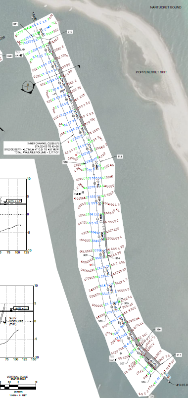
Inner Channel Pre-Dredge Survey – The shaded areas are the sections that require dredging.
This channel is authorized to -5′ Mean Low Water (MLW) with a 1′ Overdredge allowed.
Inner Channel Post-Dredge Survey – the shaded areas that were shown in the Pre-Dredge survey have been removed.

The Cod Fish II dredging in the 1916 Channel.

